
If you are searching for a marine GPS, then you’re obviously someone who either already enjoys getting out on the water during your free time or who is seriously considering it – so you’re already on the right track! Choosing the best marine GPS can seem like a tricky business, no matter if you’re a seasoned old sea hand or a complete novice when it comes to sailing or motor watercraft, but don’t fear, we are looking to provide some help here.
All sorts of people can benefit from owning a great marine GPS. Whether you make your living out at sea or you’re a serious amateur fisherman, you could be an occasional weekend sailor or an experienced and die-hard yachtsman. No matter what your specific preference for watercraft, and however you like to take to the waves, a great marine GPS will help you be safer because it will significantly improve your water navigation accuracy and make for good sailing or motorboat safety. We compiled a list of top 6 picks, and the Garmin GPSMAP 64st deserved to be our Editor’s Choice.
More features: dual battery system (2 AA traditional batteries or rechargeable NiMH, Lithium), high-sensitivity GPS and GLONASS, 8 GB of internal memory, Garmin Connect, 3-axis compass with barometric altimeter, VIRB camera control, heart rate monitor, temperature sensor, speed/cadence
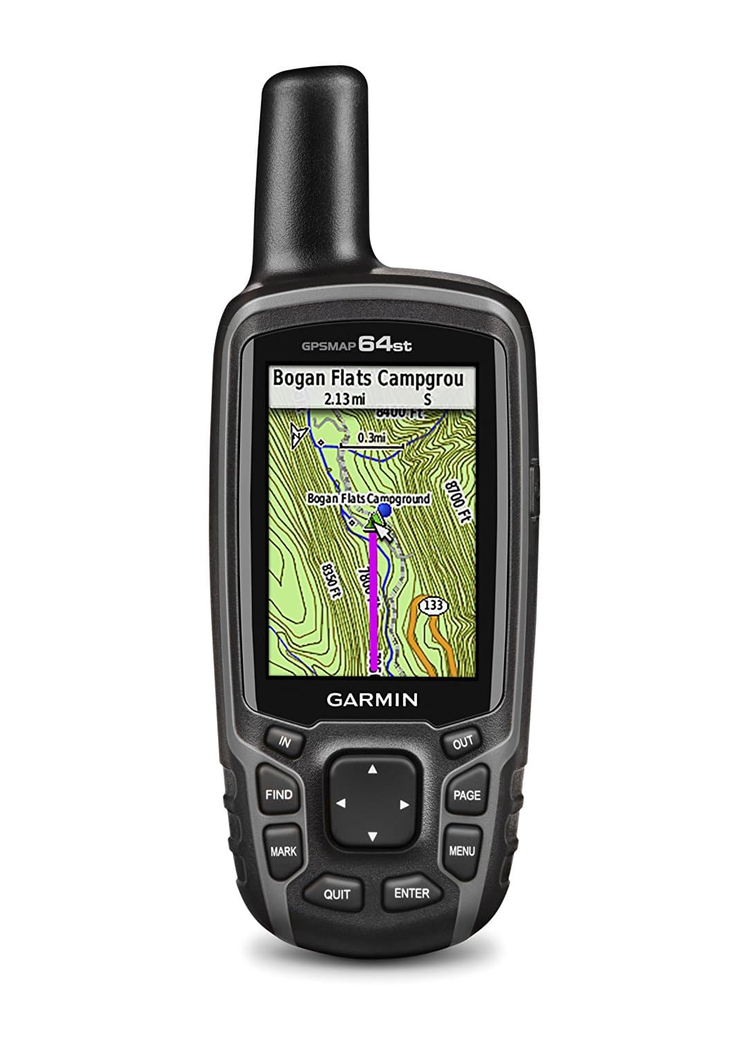
The Garmin GPSMAP 64st with TOPO U.S. 100K maps is a lovely handheld marine rated GPS unit that will have many buyers reaching for their wallets. This tiny device offers great functions to many users who want a magnificent all-round navigator. It has excellent topography capabilities in a small and very portable package.
The display on the Garmin GPSMAP 64st with TOPO is manufactured to be Sunlight-Readable -which is going to be a massive help where water glare occurs on sunny days. Screen size here is 2.6-inch, and this is a full-color display. Garmin claims a battery life of sixteen hours, but it’s going to depend on how actively you use this device.
The Garmin GPSMAP 64st with TOPO is IPX7 rated for water ingress, so you’ll have no problems with functionality in even the roughest of conditions.
Memory internal to this device is a whopping 8GB for its size and weight.
Depending on your initial budget, you can use the Garmin GPSMAP 64st with TOPO with either a rechargeable battery pack or two standard AA batteries.
This device is fully wireless-enabled. It features a compass, barometer, temperature sensor, and even an altimeter.
More features: Dual Beam PLUS sonar, multi-range CHIRP, depth, speed, temperature monitoring, international languages
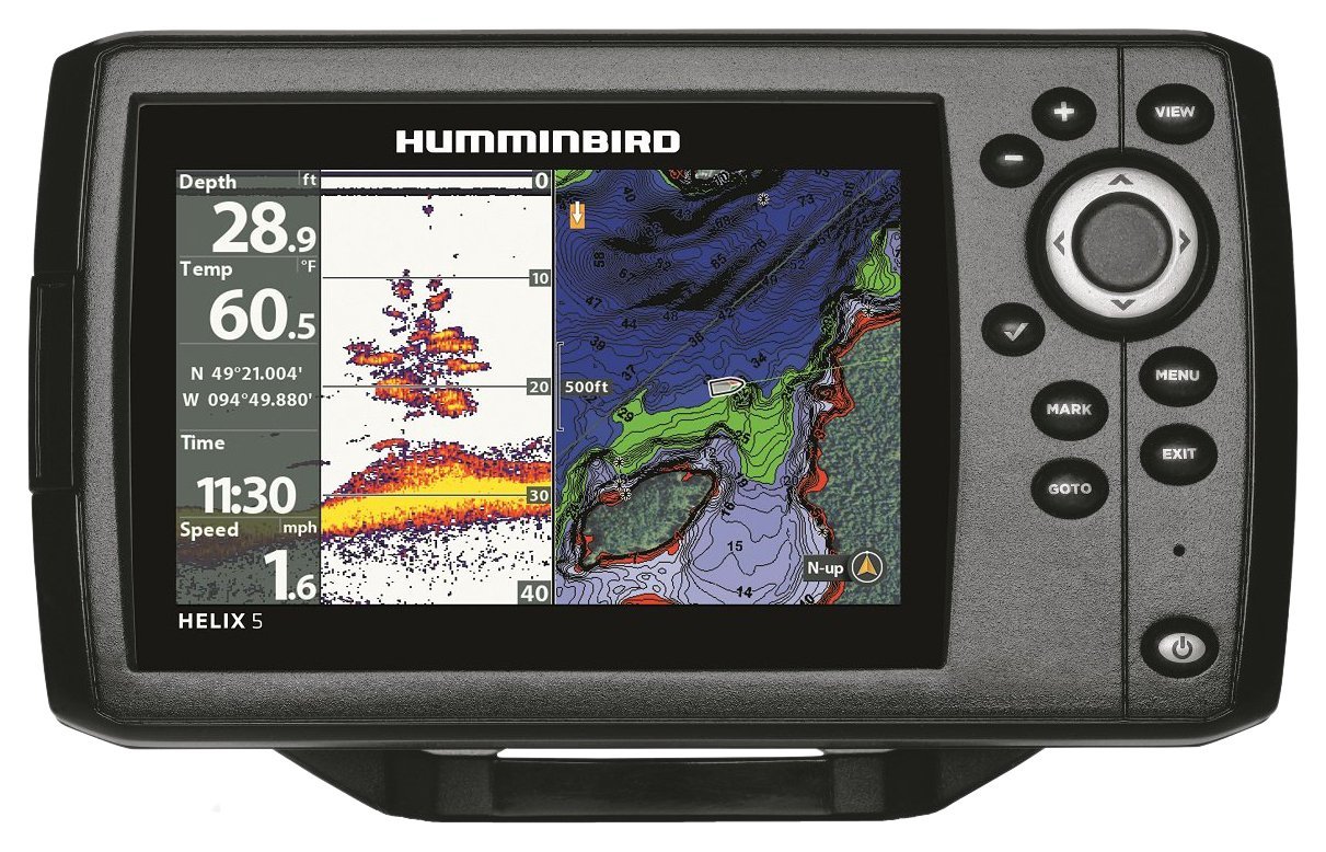
The Hummingbird HELIX 5 is exactly the sort of marine navigation equipment that many people are looking for. This package caters for a broad range of boaters and fishers, and it’s easy to see why it’s become a popular choice.
This GPS device features 480 X 800 5-inch WVGA display, and that has marvelous clarity in any lighting conditions you’re likely to encounter out on the water.
You get excellent imaging with this unit – and that means both to the sides of your craft as well as down to the bottom, via the powerful Fire Sonar capability. The GPS mapping ability of the Hummingbird HELIX 5 is convenient and easy to use, so you’ll have no trouble getting all of that fresh fish back to the harbor in time for dinner.
Precise Internal GPS Chart plotting with built-in UniMap cartography and the ability to save waypoints puts this unit out in front of many of its competitors, whilst you also get compatibility with Hummingbird Lake Master charts.
There is a water surface temperature gauge built into the transducer, and this unit has a very solid-looking construction. All in all, the Humminbird HELIX 5 CHIRP GPS G2 is going to turn a lot of head and make it onto a lot of boats.
More features: IPX7 waterproof rating, 3-axis tilt-compensated electronic compass and barometric altimeter for heading/altitude/weather, dual battery system (2 AA traditional batteries or rechargeable NiMH, Lithium)
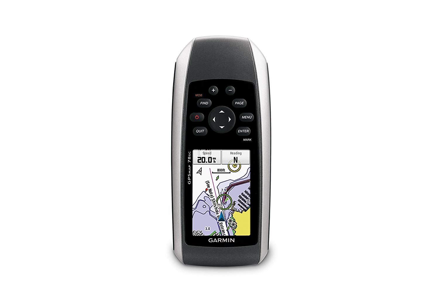
The Garmin GPSMAP 78sc appeared in this list because it is an excellent option for portability and comes in a very nice lightweight package.
What you get here is a reliable Garmin GPS that comes full of preloaded coastal charts covering the whole of the mainland United States, and also includes Alaska, Hawaii and Explorer Chart data for the Bahamas. That isn’t a bad plus for this unit, and it is simple to operate. Furthermore, do not forget about its low price, which is quite important for the average American fisher or boating enthusiast.
The Garmins GPSMAP 78sc has a basic 2.6-inch (measured diagonally) display – so don’t expect anything too large and if you’re short-sighted, keep your glasses handy. If you do manage to drop the Garmin overboard, it will float – which is a great touch.
There’s a Micro SD slot for additional maps, and 1.7 GB of internal memory. For its small size, it is enough to do the job for you. The Garmin also has wireless capability, and the manufacturer claims twenty hours of battery life.
All in all, his is an excellent option by Garmin on this list due to its compact design and portability.
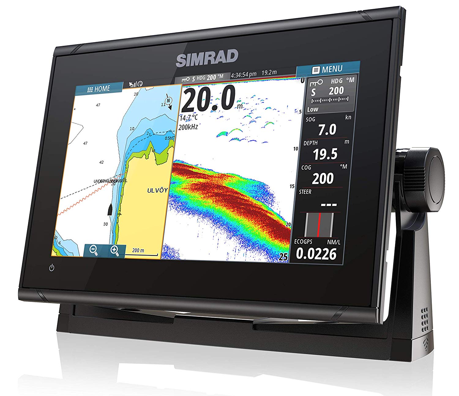
More features: fast10 Hz GPS receiver, can be combined with Simrad radar, compatible with Active Imaging, TotalScan and HDI Skimmer transducers, mobile device connection, simple to use multi-touch touchscreen, works with the WM-3 SiriusXM satellite weather module (North America only)
The Simrad GO9 XSE is a marine GPS that is packed with the features and capabilities you will need to stay safe out on the water, and it’s going to be an excellent choice for many people.
The interface of the Simrad GO9 XSE is what first catches your attention. This thing is so smooth to use and navigating its menus and features makes navigating your waterway of choice an absolute breeze. The Simrad GPS is a full chart plotter device and is widely supported by chart developers – which makes things easy.
The Simrad GO9 XSE has 10 Hz receiver, which means you’ll never be behind the times while on the move. You get sonar for assessing and safely navigating marine structures and full wireless connectivity built-in. For storing all of that map data, the Simrad GO9 XSE offers twin Micro SD slots. All in all, this dual-mountable marine navigation system provides everything you’ll need to stay safe while you sail.
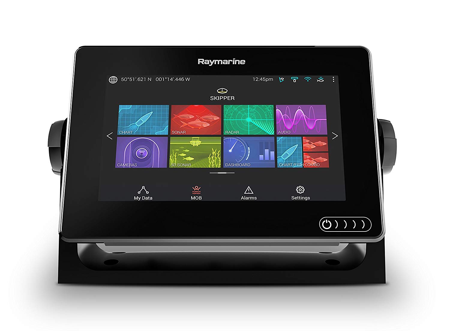
More features: includes RV-100 transducer, multi-touch touchscreen,
IPX6 / IPX7 waterproof rating, compatible with FLIR M132 and M232 thermal night vision cameras, built-in Real Vision 3D Sonar
The Raymarine Axiom 9 is a curious little marine GPS unit because it has a heck of a lot going for it, yet lets itself down in some key areas. As a marine GPS unit, the Axiom 9 functions well. For that reason, the Raymarine effort makes the top three places on our list.
The Axiom 9 has a handy nine-inch screen that displays well, and the touch capabilities make using this system a breeze. There’s a quad-core processor inside, so this machine is no slouch, you’re also fully wirelessly enabled and open to both vector and raster charts.
All in all, as a pure navigational tool, go and buy one. However, if you want to use the so-called 3D™ sonar system, you must be aware that people reported some difficulties with it. So it is essential to check the whole system working if you want to get decent marine GPS navigator.
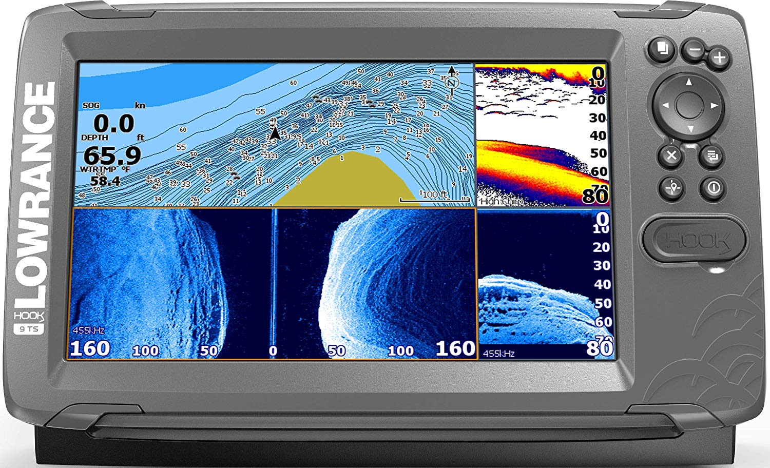
More features: includes TripleShot Transducer, easy set-up, works as fish finder with wide-angle CHIRP sonar
The Lowrance HOOK2 9 is primarily a perfect fish finder that has excellent navigation functionality too. You get a pretty refined version of automatically tuning sonar on this device, and you don’t need to shell out extra cash for a transducer. The device will suit many occasional boaters and fishermen because it combines menus which feel very mobile phone-like with advanced technology to make using it fun and easy.
The HOOK2 9 uses a wide-angle sonar cone to deliver crystal clear representations of what’s below and around the boat. Fishermen will love that because it provides a vast coverage area when scanning for fish.
Moreover, the option to plot and add waypoints means you can follow your trails, save your best fishing spots and get straight back to your favorite places the next time you get out. The HOOK2 9 is a trendy device for navigation because it’s compatible with popular maps, such as Navionics+. That makes it a great choice if you simply want to get navigating straight away and you want a wide range of map options.
Setting up the HOOK2 9 is easy – there are none of the intricacies of installation that are found with more complicated models, and you’ll get the full functionality in no time.
We know that there are many different types of marine GPS devices out there on the market. Whether or not you’re new to the business of attempting to buy a marine GPS, you’ll find some useful information in the following guide, that’s created to make the buying process easier for you. Whatever your needs – you may be looking for the best portable marine GPS, or you might have more significant ideas – this guide will help.
As with so many things that you will get during the course of your life, buying the best marine GPS for you will depend on several factors. That is always true, whether or not a purchase is connected with our work or with our leisure time, and with the activities, we get involved with in order to relax and have some fun.
The marine GPS crosses the line of leisure and work. It’s one of those devices used by professional seafarers and hobbyist sailors alike. What your choice will partly boil down to is the fact that the item will form part of your overall strategy for safety out there on the water, and significantly improve your chances of getting on and off the water without an accident. This is an essential piece of equipment on any vessel, and it is wise to make choices based on your planned activities and the requirements connected with that.
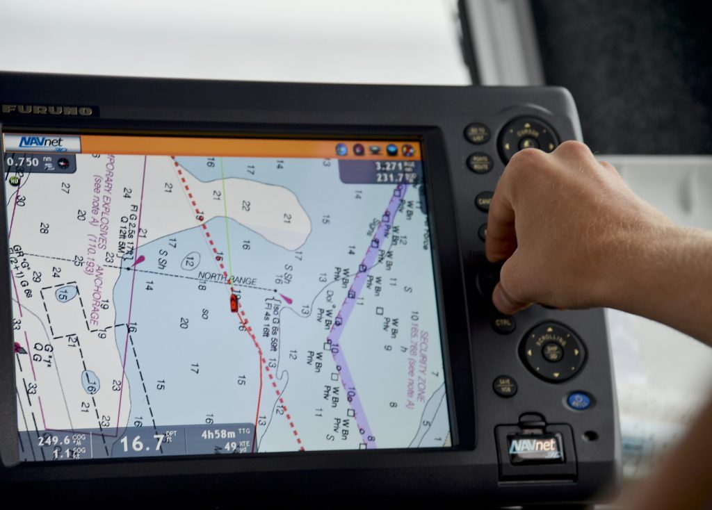 Chart plotters are widely used for maritime navigation. They use a method that combines the best features and capabilities of GPS navigation with the many advantages which electronic navigational charts bring to the party. The best marine GPS chart plotter displays your own position and heading. You also get the information about your current speed. Many different forms of technology can be incorporated into a chart plotter system which makes them extremely versatile and customizable to the needs of particular sailors or seafaring professionals. For instance, you can include the data from echolocators and sonar on your display.
Chart plotters can be divided into two categories: handheld and fixed mount marine GPS units.
Handheld devices are small and portable. They are easy to carry it with you and take it to any vessel. However, the functionality may be limited, as well as the memory of the device.
Fixed-mount marine GPS models offer you a variety of settings and chart options but you must keep in mind that they are less water resistant and not portable at all, compared to handheld models.
From mobile phone-sized GPS navigation systems to fully integrated, sophisticated instrumentation versions of chart plotters with overlaid sonar and echolocation ability – there are many shapes and sizes when it comes to marine GPS devices.
The larger the display you go for, the less tiring it will be to use, and the easier it will be to get at-a-glance feedback from your device during busier moments at sea. As with most devices, the bigger the display, the more convenient it is.
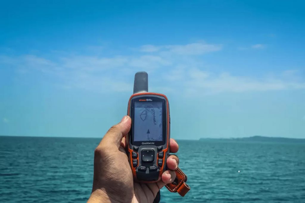 Chart options
Charts for chart plotters are available to download, and as with most things on the World Wide Web, there are both free to use and paid versions. The particular charts you require will depend on whether it is compatible with your specific marine GPS device or not, and how you want to use it. Chart quality is important, and some charts feature more reliable information as well as an increased number of features.
You’ll need to update your charts frequently to ensure that you have all of the latest information available. With GPS navigation systems for marine use, this is usually done manually, and because the memory on most marine GPS systems tends to be lower than your average laptop, you’ll often need to do it by using a computer and a USB storage device.
Reliability is always a key concern for boaters and fishermen and today’s GPS devices provide great peace of mind when the weather turns, visibility becomes limited, and you will need to be sure that you’re heading in the right direction.
Today’s marine GPS devices are also easy to use and make and maintain good GPS connections in all conditions. Plotting your route couldn’t be simpler than with a modern GPS, and maps which show great details making the setting of your course a breeze.
In terms of essential equipment, every single boat or watercraft should have a marine GPS on board. Not only do they make boating or fishing more fun, but they’re also a sure-fire way to stay safe.
When you’re choosing your own marine GPS device, your decision will largely be influenced by different factors. First of all, the type and size of your craft are going to be points worth considering. What navigational and sensory abilities do you want to have from your own boat or watercraft? How big is your own craft? Where do you need to navigate, and what determines the safety?
The GPS device you will need for a twenty-foot boat that you launch from a boat ramp straight off of a trailer is going to be a completely different from the unit for a larger fishing boat that runs in and out of a tight harbor regularly.
On smaller boats, much of your maneuvering will be accomplished visually, but you’ll still need a degree of capability to navigate. On larger pleasure or commercial crafts, you may need some echolocation and sonar ability to go through shallower depths and tighter spaces successfully. Luckily, there’s a marine GPS system for every sailor and watercraft. Commercial fishing boats and even the more serious of amateur or hobbyist fishers out there may want to kit their boat out with the ability to use sonar-based and echolocation systems to find fish. Nowadays, this is possible with relatively small devices on the smallest of boats – whereas, in the past, this was sophisticated technology only found on large commercial fishing trawlers.
If you’re lucky, your new marine GPS device will come with all the bells and whistles. On higher-end and better equipped marine GPS versions, it’s possible to find features such as an electronic compass, a built-in barometer for monitoring weather conditions, and even equipment like thermometers – which can be a real help when you need to know which way the weather is heading or if there’s a storm approaching. Using a barometer and thermometer in tandem when you’re out on the water can be the difference between getting back to harbor before front catches you up, or getting back to harbor wet!
As with all devices that incorporate sensitive and advanced electronic components and technology, great marine GPS will not come for cheap. It’s important to be realistic when you’re looking around to buy your own marine GPS, and it is certainly true that of all of the items of equipment you will choose for your watercraft, a good quality GPS should be very high up the list.
In the modern-day, we no longer need to navigate by the stars, so you really should try to buy as many of the features a GPS offers as possible. Whatever their cost in dollars, these devices are priceless out on the water, but the more features you require, the more you will pay. You’ll find a great range of prices on our list of the six best marine GPS devices – ranging from $230 to $1500 – there’s a device for all budgets.
While it’s certainly possible to get hold of a very usable marine GPS – that absolutely will do a job for you when you’re out on your boat – prices vary across a wide range when it comes to advanced electronics. The best advice is probably to direct your search based on the features you are going to need. It’s also always a great idea to buy the best device you can afford within your budget. When it comes to choosing a marine GPS, it’s also justified to add that you should budget as much as possible – because these devices are largely about safety when you’re out there enjoying a marine environment.
So, we’ve looked at the best marine GPS navigators out there and found some great examples for you to choose from. We’ve also delved into the features and options you can expect to encounter when you’re looking for your own device. The top spot on our list went to the very excellent Garmin GPSMAP 64st with TOPO U.S. 100K maps. These devices are high-tech, and the Garmin GPSMAP 64st with TOPO U.S. 100K maps can’t disappoint you at all.
In second place on our list of the best marine GPS devices was the Humminbird Helix 5 Chirp GPS G2. If you prefer sailing on sunny days, then you want to get rid of the glare on your screen. This fish finder with GPS can deal with that problem and give you the ability to add waypoints and follow your trails.
The marine GPS device sitting in third place on our rundown of the best marine GPS navigators was the brilliant Garmin GPSMAP 78sc. This compact marine GPS with inbuilt compass, barometric altimeter and many other features is an amazing choice for any boater. Also, it has IPX7 waterproof rating and floats on the water surface.